Project Definition
YUMA COUNTY
Over the course of three months, a file geodatabase and print maps were produced to access and monitor land changes temporally on select ranches in Washington County and Yuma County, Colorado.
County information (Streets, boundaries, and cities), public land survey systems gird, and NCRS soil data was acquired and compilied into the geodatabase. Tax accessor parcels of the ranches were located and digitized in arcgis using the PLSS system grid. Below is an overview of Yuma and Washington Counties.
This project facilitated the creation of new data but also involved researching and understanding the data given. Public land survey system information was downloaded and unzipped. Knowledge of how the PLSS system works is necessary to use the data acquired. The purpose of this map was to display ranch properties in Yuma, County. Parcel locations were georeferenced and then digitized by downloading an image of the parcel area from the counti’s tax assessor website. The downloaded parcel images were georeferenced by finding the appropriate location using the PLSS grid.
Data Acquisition
Natural Resource Conservation Service Soil data was acquired. The survey utilizes Microsoft Access for data management. The data consists of both shapefiles and tabular data. There are over 3,000 different surveys, the one used for this project includes data on the quality of farmlands. Tabular data is inserted into access because the data columns have no titles. The access database was joined into ArcGIS Pro and the shapefile was joined with the soil data using the FIPS code and a state identifier. Prime farmland areas were displayed for the ranches and the spatial information outside of the ranches was clipped.
Meteorological data average for the year and NAIP imagery was acquired as a basis for showing the seasonal and annual land cover change. The meteorological data and imagery of the ranches were compiled into multiple PDFs of an overview and individual ranches for September 2019.
Data Management & Geoprocessing
CROW WING COUNTY
The following two maps access the economic and spatial characteristics of seasonal homes and homeowners in Crow Wing County Minnesota. Parcel data acquired for analysis was not organized and needed to be edited when it came to addresses. Field calculations were performed to separate out states and zip codes from a field. This was done in ArcGIS Pro and Excel. Two maps were produced, one displaying the seasonal lakeside homes over $500 million, and the other displaying where seasonal homeowners live.
This map was created through the management of databases and through queries. Select by attribute was used to display only seasonal homes that are greater than half a million dollars. A buffer analysis was conducted to only display seasonal homes along the lakesides.
The map above displays where seasonal homeowners in Crow Wing County Live. To produce this map. The database for the county tax accessor parcels was altered using excel. Functions were written to separate out the state names from the three address fields that had no distinct structure. The state names were counted and put into a new field. The spreadsheet was then rejoined into ArcGIS pro. Zipcodes were also selected by employing a function, this was only done for the homes within Minnesota.
Data Analysis
Classification
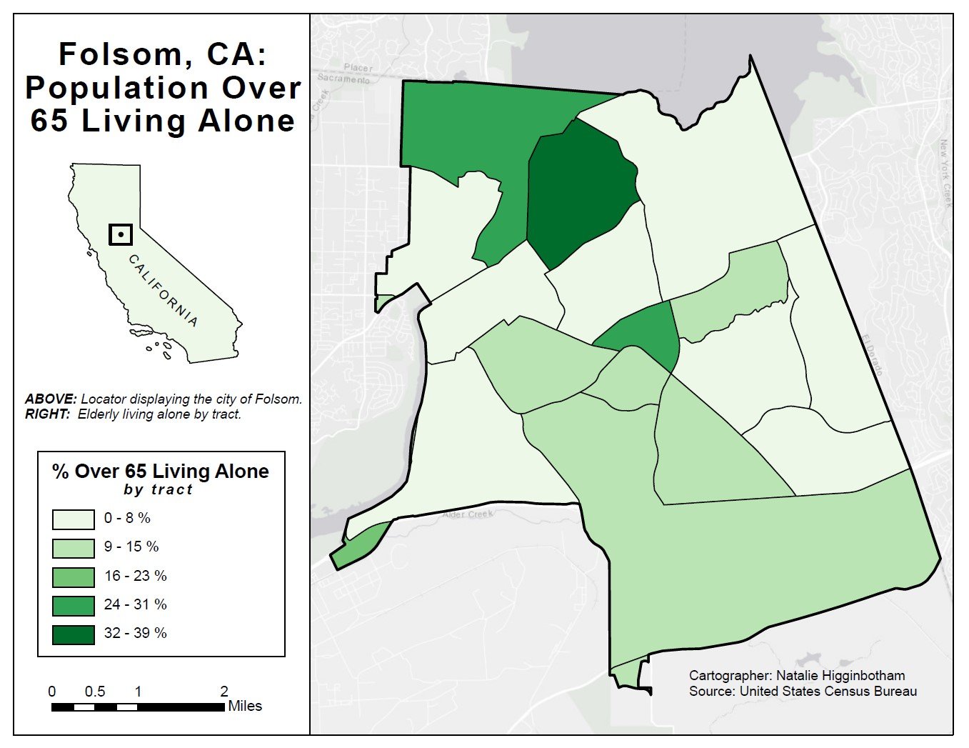
The following maps display classification methods of data regarding different census categories. The first two focus on which census tracts have the highest concentration of elderly residents living alone, or with an ambulatory disability. Classification methods were carefully selected to determine if there were any patterns in the data.


